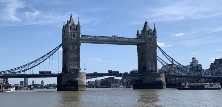
The rise of the automobile as the most common form of transportation after World War II made building highways a top post-war priority. As cities were connected by larger highways with higher capacities, and the suburbs blossomed on the edges of urban areas, the need for high-capacity corridors through major cities became more acute. Before 1950, most highways were routed on city streets in urban areas, streets that often were designed for a fraction of the traffic.
With Eisenhower’s Interstate Highway plan, the die was cast. Urban planners such as Robert Moses saw their visions of grade-separated thoroughfares to carry traffic through cities quickly come to life. The promise of living in the idyllic suburbs and working in the city seemed to justify the cost. Unfortunately, as the first wave of construction tore through cities, it became apparent there was another cost. Historic neighborhoods, some over a hundred years old, were suddenly torn apart, divided by six to ten lanes of speeding traffic. It is hard to imagine how different life in these neighborhoods was before the freeways were built. Here are five examples of Portland neighborhoods that fell victim to the all-mighty automobile.
Lents
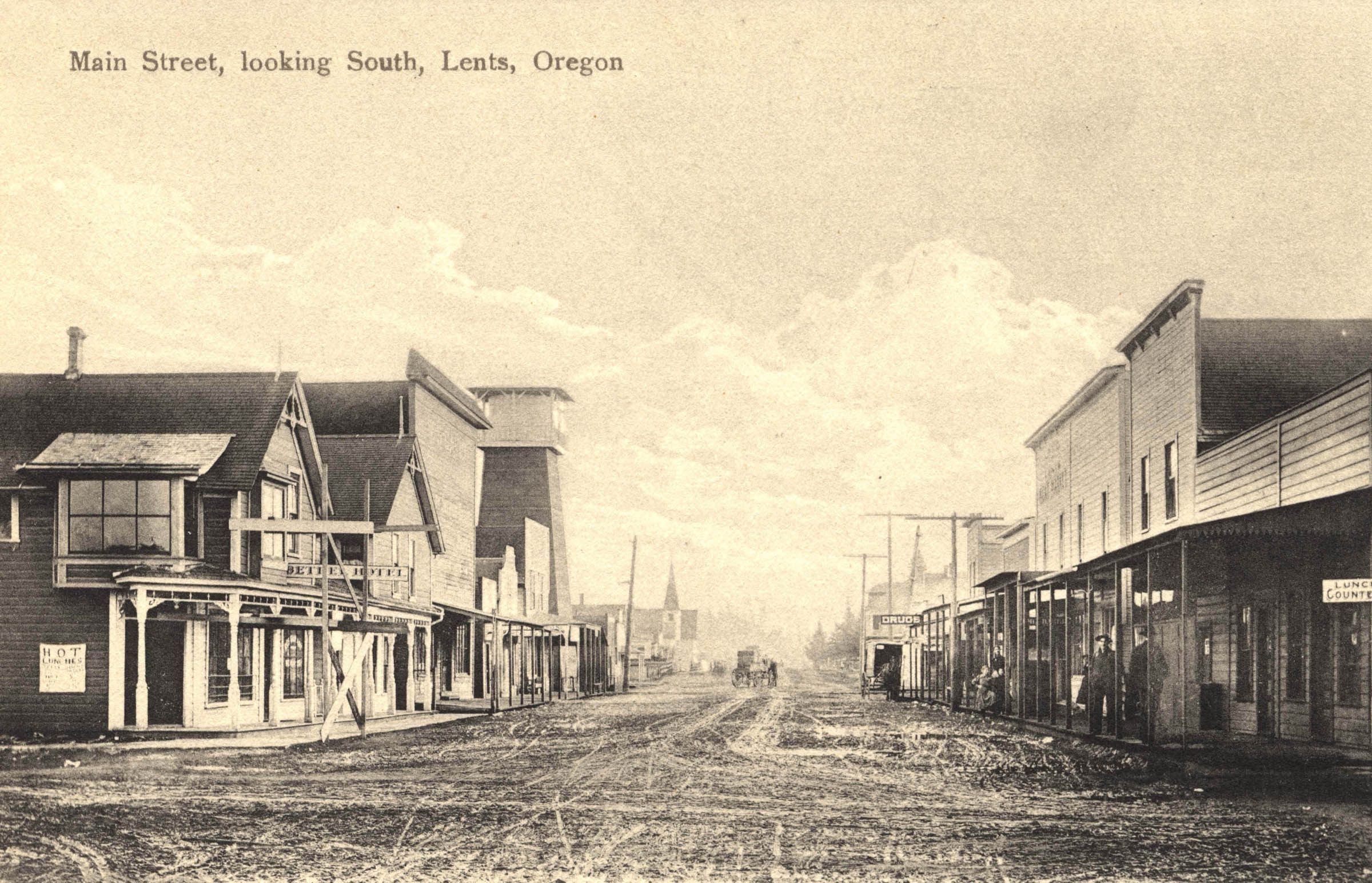
Lents long before I-205 tore through the town centerLents was originally platted by George Lent in 1892, but had been settled even earlier by his father, Oliver P. Lent. Lents, like Portland, was so named because of a coin flip, with Oliver Lent on the winning side of this one. The town center was located around the three-sided intersection where SE 92nd, SE Woodstock and SE Foster all meet. Even though Lents was annexed by Portland in 1912, its distance from the downtown core and lower-income population made it a low-priority for the growing city. By the 1970s, its political clout was no match for more powerful neighborhoods such as Laurelhurst, who were able to fight construction of I-205 through the 39th Ave. corridor as originally planned. Instead, the corridor steadily moved east until it ran right through Lents’ Town Center, effectively destroying the core of the community. While the town center is now an Urban Renewal Area (and finally benefits from the promised MAX light rail line that came with freeway construction), it has yet to recover from the damage done.
Downtown/Goose Hollow
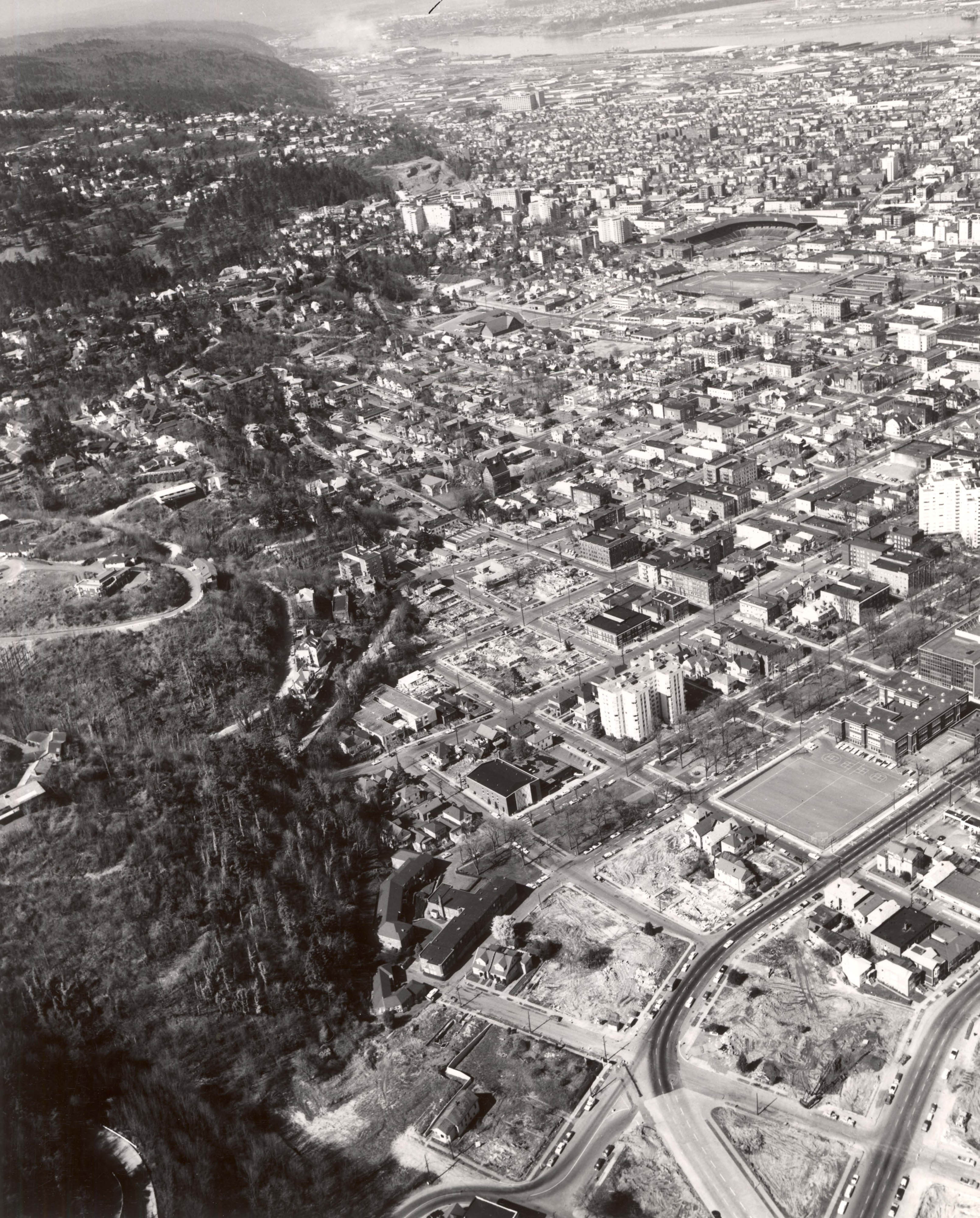
Southwest Portland shortly before I-405 divided the downtown areaThe I-405 corridor through downtown likely occupies the most valuable real estate of any of Portland’s freeways. This project destroyed 26 blocks of prime real estate along the southern and western edges of the downtown core. While the sunken grade and frequent at-grade street crossings make the freeway less of a barrier than the others on the list, the construction’s disregard for the historic connections between neighborhoods such as Goose Hollow and the downtown core means that it makes the list.
Brooklyn
I doubt many neighborhoods have suffered as much as Portland’s Brooklyn neighborhood has at the hands of highway progress without having an actual freeway built through it. One of Portland’s earliest neighborhoods, it survived complete destruction when the Mt. Hood Freeway was cancelled in the late 1960s. By that time, the expansion of Powell Boulevard had already torn through it’s town center (located at Powell and Milwaukie) and it’s connection to the river was severed by McLoughlin Boulevard. To top it off, an underpass for Powell Boulevard was built at it’s intersection with SE 17th Ave. to allow train traffic to cross at-grade, leaving blocks and blocks of completely impassable asphalt. Luckily, Brooklyn has somehow survived all that to become a desirable neighborhood again.
Albina
Now considered an “area” comprising several smaller neighborhoods, Albina appeared on the map in 1873, and like Lents was originally a separate town, absorbed into Portland in 1891. As a low-income neighborhood (and one of Portland’s few neighborhoods with a predominantly African-American population), it was an easy target for planners of the “Minnesota Freeway” (today’s I-5) who wanted to avoid a legal fight with more wealthy residents. The freeway cut a two-block wide chasm through the entire Albina area, dividing several historical neighborhoods and causing damage that the area is still struggling to recover from.
Corbett-Lair Hill
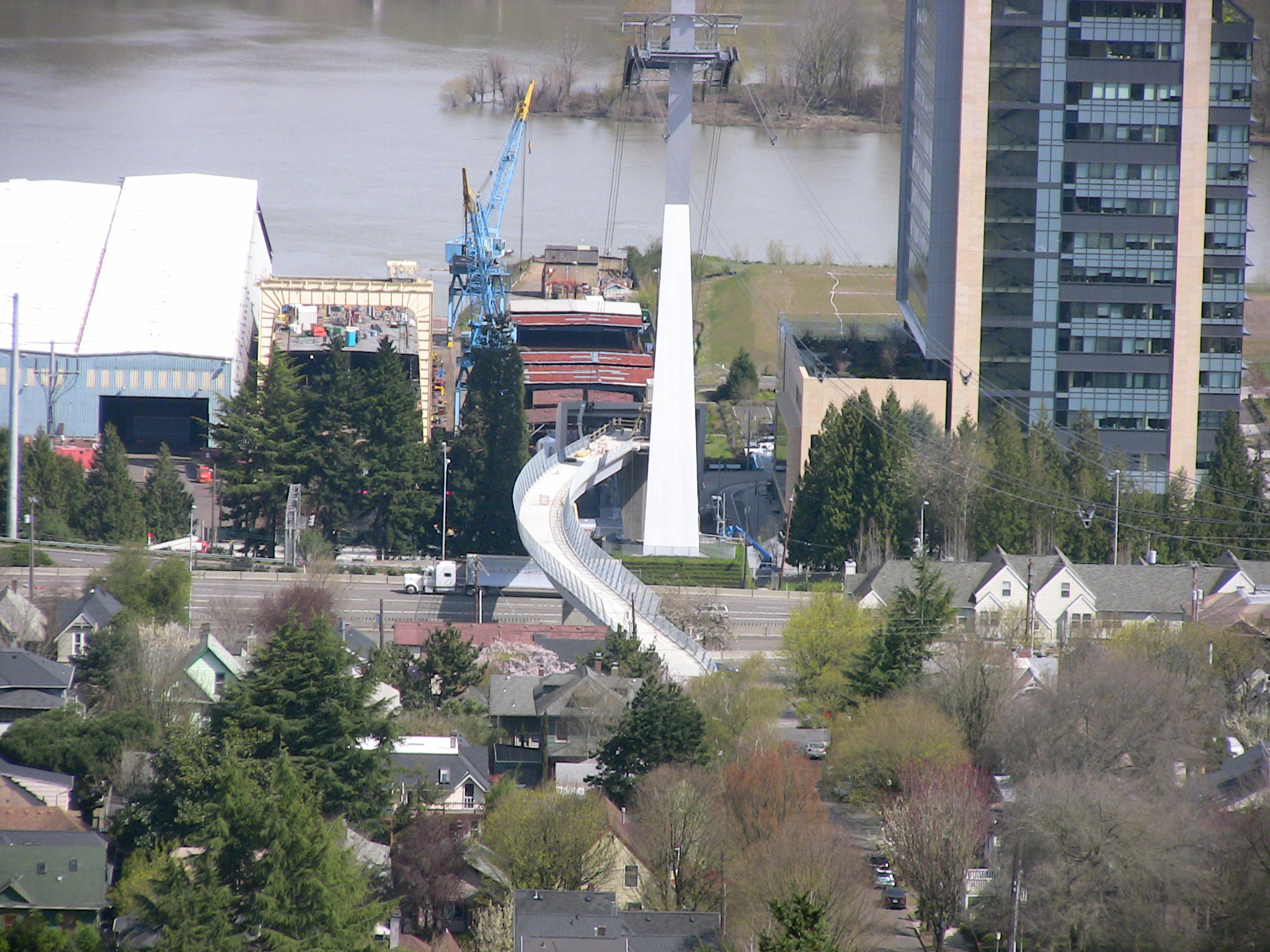
The Gibbs Pedestrian Bridge reconnects Lair Hill to the waterfrontThe Corbett-Lair Hill neighborhood (now officially part of the South Portland Neighborhood Association) is one of the oldest in Portland, lying just south of the downtown core. Squeezed between the West Hills and the Willamette River, the neighborhood enjoyed excellent views and easy access to the river for years, until the construction of I-5 cut an impassable barrier through the neighborhood. Only recently has pedestrian access to the river been restored, with the opening of the Gibbs Street Pedestrian Bridge in 2012.
As I said in my original post, “Five of Portland’s Greatest Mistakes“, I love this city and I think we make more correct decisions than bad ones. Still, mistakes are made that many of us wish could be undone; here are five more. 1. Destroying the original streetcar system In the early 20th century, Portland had a streetcar system that…
Update Jan 2021: Watch our new video above for more information and a bonus Portland viewpoint! (Originally published July 10, 2011) Catching a great view has always been one of my favorite pastimes. There are very few people who don’t enjoy a magnificent view from a high vantage point, and Portland is chock full of fantastic spots to indulge.…
As you can probably guess, I love Portland. More than that, I firmly believe that, as a community, Portland does more things right than it does wrong. No city is perfect, though, the Rose City included. Here are five big mistakes that we have made as a community in the past. 1. Marquam Bridge The Marquam Bridge is almost certainly…
We use cookies to ensure that we give you the best experience on our website. If you continue to use this site we will assume that you are happy with it.OkNo